The Insight / Stratos can display altitudes as well as GPS information in a variety of formats. By default these altimeters will display only the altitude, in large numbers that are very easy to read in all light conditions. More advanced users can configure the displays used for freefall and canopy descent to get extra feedback for your exact needs.
In Aircraft (Ascent) Screen #
When the altimeter detects ascent in an aircraft it will automatically change the altitude display to the following fixed fields. This information is useful to assist with spotting and exit separation. When the altimeter detects an exit from the aircraft it will automatically switch to the altitude screen that is selected from the menu Settings->Altitude Display->Mode.
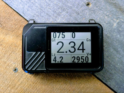
The center of the aircraft mode screen shows the altitude. The other information shown on this screen are:
- Vertical Speed (Vs) – Bottom Right
- Ground track (Gt) – Top Left
- Ground speed (Gs) – Top Right
- Distance to LZ (Lz) – Bottom Left
All of the fields except for altitude and vertical speed require GPS signal in order to function.
Distance to the LZ requires saved LZ coordinates to function.
Stratos only: The Stratos will display distance to the HARP while in the aircraft, if the HARP was configured. Otherwise the Stratos will show the distance to the DIP (aka LZ).
To change the units for each of the data fields, go to the Display Units section.
Standard Altitude Display #
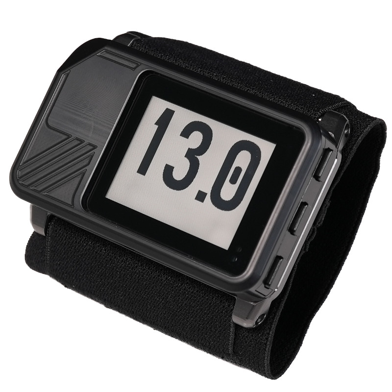
By default the altitude display for freefall and canopy descent is the “standard” display. This display format keeps things simple and only displays the altitude using large, easy to read numbers.
Deep and Steep recommends using standard display for newer jumpers, AFF students, and anyone who doesn’t need in air GPS feedback. Keep it simple.
Nav Display (GPS Navigation Data) #
To configure the Insight / Stratos altitude display for GPS data (this only applies to freefall and canopy modes), first switch to the home screen. Press the center button to open the menu, then navigate to Settings->Altitude Display->Mode. Use the center button while the cursor is on the “Mode: “ row to cycle through the display options.
- Standard: Only show the altitude for freefall and canopy descent (standard altitude display)
- Nav CP: Canopy descent will show extra GPS data, and freefall will show only the altitude in large numbers (standard altitude display)
- Nav CP+FF: Canopy descent and freefall will show extra GPS data
Remember: These display options do not change the ascent screen that you see while on the ground and in the aircraft. The ground/ascent screen is fixed data.
Nav Display Options #
Within the Settings->Altitude Display menu there are options to configure what is shown in each corner of the display. Top left, top right, bottom left, and bottom right.
The following options are available for each corner:
| Description | Display Prefix | |
| G. Speed | Ground speed displays the current speed across the ground. Keep in mind the winds aloft will change the ground speed, so don’t expect this to be the exact forward speed of the canopy. | Gs |
| G. Track | Ground track displays the direction of movement across the ground in degrees. Keep in mind the winds aloft can cause drift side-to-side, so the ground track will not always equal your canopy heading. This direction is in relation to true north, unless a magnetic declination is set. | Gt |
| LZ Dist | LZ distance displays the distance to the marked landing zone, if an LZ was marked before the skydive. | Lz |
| V. Speed | Vertical speed displays the speed speed averaged over 2 seconds. V- indicates descent, and V+ indicates a climb. | V+ and V- |
| LZ Glide | LZ Glide displays the glide ratio needed to reach the marked LZ from the current altitude. | Lg |
| Cur Glide | Current glide displays the current glide ratio. | Gl |
| Turn to LZ | Turn to LZ displays a direction arrow and number of degrees to turn in order to move towards the marked LZ. | Tu |
| None | Leave this field blank on the display. |
Remember: To change the units shown for freefall (FF) and canopy (CP), go to the Display Units section.
LZ Glide Altitude #
The LZ Glide Altitude controls how high above the ground you want to be when you reach the LZ. The Insight / Stratos will use this altitude to calculate the LZ Glide needed to reach the LZ.
The Current Glide indicator (if selected) will show an “!” (exclamation point) after the glide if your current glide is not enough to reach the LZ at the set altitude.
For example if you set LZ Glide altitude to 1,000 feet and your altimeter display shows “Gl: 1.6!” this indicates:
- The current glide ratio is 1.6 to 1
- At the current glide ratio you will not reach the marked LZ at a minimum of 1,000 feet AGL


